Over the weekend, eastern parts of Africa were threatened by Tropical Cyclone Dikeledi. What started as a slight tropical disturbance between Indonesia and Australia on 2 January progressed westwards while developing into a depression over the week that followed.
The depression strengthened into a moderate tropical storm with heavy downpours and gusty winds exceeding 39mph (63km/h) across central parts of the Indian Ocean. At this time, the system was named Dikeledi. It continued westwards and deepened into a tropical cyclone on the evening of 10 January as maximum sustained wind speeds hit 74mph – the equivalent of becoming a category 1 hurricane in the Atlantic Ocean.
Dikeledi made landfall on Saturday across the north of Madagascar, between the cities of Vohemar and Antsiranana. Heavy rain and spells of strong wind swept across the north of the island, killing at least three people, before Dikeledi downgraded into a tropical storm and departed into the Mozambique Channel.
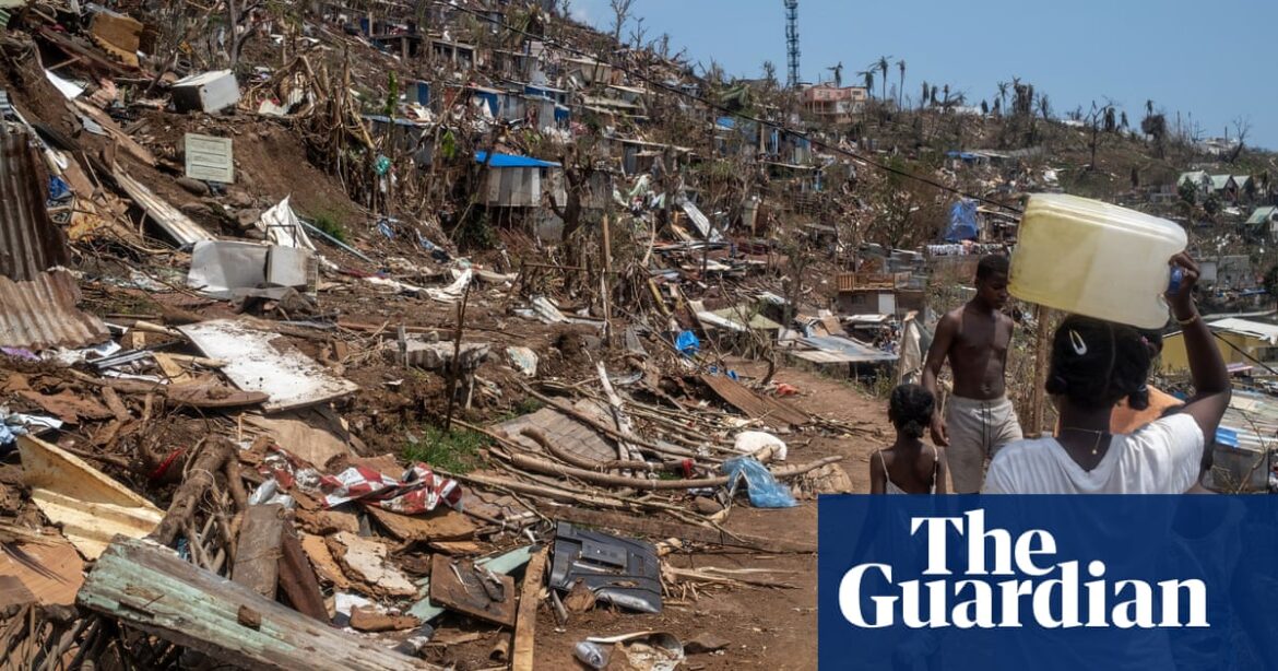
The system then passed to the south of the French territory of Mayotte, and brought heavy rain that led to flooding and mudslides on the archipelago, which followed the destruction of Cyclone Chido in December. At least 14,500 people took refuge in emergency shelters, where they will remain until the rain clears late on Monday.
This week Dikeledi is forecast to track southwards down the Mozambique Channel. Model projections indicate it is likely to reintensify into tropical cyclone status at the start of this week, bringing heavy rain, thunderstorms and strong winds to parts of Mozambique. Dikeledi is expected to deepen into an intense tropical cyclone with mean wind speeds above 100mph on Wednesday and Thursday as the system tracks towards the south-east, skirting the south of Madagascar.
after newsletter promotion
Strong winds were observed near the Adriatic Sea on Sunday with stations in Croatia observing north-easterly wind gusts of about 45mph, although these peaked closer to 60mph during the morning. These winds are part of a phenomenon known as the Bora, a type of katabatic wind – a cold wind that strengthens downslope of high ground under gravity – which occurs most commonly during winter. The Bora is expected to continue through Monday before generally easing on Tuesday.
Source: theguardian.com


