There are predictions of a “very wet” beginning to the new year for several regions, with significant amounts of rain anticipated for certain areas in the UK and numerous flood warnings currently in effect.
The Met Office has put out alerts for rain and wind in many areas of England and Wales on Tuesday, with a yellow warning in effect. The most intense rain is expected in parts of Wales, the Midlands, eastern England, and Yorkshire. Coastal regions may experience gusts up to 60mph, while other areas could see speeds of 40 to 50mph, according to the forecaster.
There may be travel disruptions due to heavy rainfall on already saturated ground following recent wet conditions.
There is a forecast for additional rain on Monday evening and overnight, followed by another period of intense rainfall that will move towards the northeast on Tuesday.
The Environment Agency has issued 39 flood warnings and 200 flood alerts for England, while Natural Resource Wales has one flood warning and 11 flood alerts for Wales. The Scottish Environment Protection Agency currently has five flood alerts in effect.
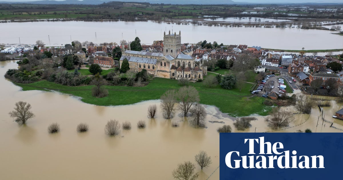
Pictures display flooded areas encompassing the town of Tewkesbury in Gloucestershire, with the abbey cut off by the heavy rainfall.
According to meteorologist Jonathan Vautrey from the Met Office, it appears that a significant amount of rain will spread across most of England and Wales on Tuesday, resulting in widespread wet conditions once more.
He stated that there may be brief periods of clearer weather in parts of south-eastern and eastern Scotland during the bank holiday. However, the Northern Isles, Orkney, and Shetland can expect to experience heavy rain and strong winds once again.
Temperatures will vary between 8C and 13C in a north-south direction, but with wind and rain, it will feel colder.
A weather alert for heavy rain has been issued and will be in effect until 9pm on Tuesday. According to the warning, there is a high chance of 15 to 30mm of rain falling in many areas, with some areas possibly receiving 35 to 50mm.
“The heaviest rainfall is expected to move out of south-western England and south Wales by mid-Tuesday, though it may linger into the evening in the north-east of the warned region. Strong winds will impact certain areas.”
Strong winds of up to 60mph may occur in coastal regions, while other areas could experience gusts of 40 to 50mph. This is due to a yellow weather warning for wind that will be in effect on Tuesday from 8am to 9pm. The warning states that there is a high possibility for very windy conditions to form rapidly over south-west England and southern Wales in the morning and then move eastward towards southern and central parts of England.
The statement states that in coastal regions, winds may reach speeds of up to 60mph, with a smaller chance of gusts reaching 70mph.
Winds reaching speeds of 40 to 50mph are expected inland, with a slight possibility of gusts reaching 55 to 60mph. However, the likelihood of these stronger gusts is uncertain at this time.
Source: theguardian.com


