
England and Wales are braced for heavy rain and strong winds just days after homes and businesses were flooded.
Two fresh weather warnings come into force on Sunday for wind and rain that will hit areas already saturated by downpours earlier in the week.
The Met Office has issued a yellow rain warning – meaning further heavy rain is likely to cause some travel delays and flooding – covering much of southern England and south Wales between 4pm on Sunday and 9am on Monday.
There could be between 20mm and 30mm of rain within the warning area across nine to 12 hours on Sunday, and 50mm to 80mm could fall in some localised places on higher ground, the Met Office said.
Fresh yellow rain warnings were also issued, covering eastern England between 8am on Monday and 3am on Tuesday and across north Wales and north-west England between 12.30am on Monday and 8pm the same day.
Both new warnings forecast between 20mm and 40mm of rainfall widely, with 60mm also possible in a few places across north Wales and north-west England, and between 60mm and 80mm in some areas in eastern England, the Met Office said.
The Met Office meteorologist Liam Eslick said they were expecting some “pretty heavy persistent rain” across north Wales and north-west England, with the former getting the brunt of it.
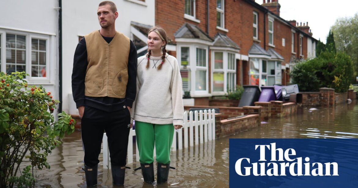
The Environment Agency had 44 flood warnings, indicating flooding was expected, and 84 flood alerts, where flooding was possible, in place across England on Saturday evening.
Meanwhile, there was a yellow warning for wind that was also predicted to cause disruption across south-west England and Wales between 9am on Sunday until the end of the day.
Gusts of between 50mph and 60mph could occur, with large waves, trees brought down, travel disruption and some power cuts, the Met Office meteorologist Becky Mitchell said.
Further rain warnings could be issued for Monday, but it was forecast to be drier later in the week, she added.
The Met Office said temperatures on Sunday would be 3C-4C below average, in the low double figures.
Another Met Office meteorologist, Craig Snell, advised people travelling on Sunday to plan ahead.
He said: “Check rail conditions before setting off, check buses are running on time, and allow extra time for your journeys. If you’re driving allow extra braking distances.
“For the areas affected under the yellow rain warning, if you are concerned about flooding, for people in England the main advice is to check the Environment Agency website or Floodline. If you live in Wales it will be Natural Resources Wales.”
England has suffered heavy rain and localised flooding in recent days, with commuters facing widespread disruption on road and rail services.
According to the Met Office, some counties in southern and central England have already had more than 250% of their average September rainfall.
Parts of the country had more than the monthly average rainfall on Monday and there were further downpours on Wednesday, Thursday and Friday.
About 650 properties were flooded in Bedfordshire, Northamptonshire and the home counties, according to the Environment Agency, which estimated around 8,200 properties had been protected.
Rail services between Shrewsbury in Shropshire and Wolverhampton in the West Midlands were cancelled on Friday after severe flooding at Wellington station and a tree on the line earlier.
The pitch at the SEAH Stadium in Wellington, home to AFC Telford United, was completely flooded on Thursday evening.
The Marston Vale line in Bedfordshire, which operates services between Bedford and Bletchley, is suspended until Monday because of standing water on the track.
Source: theguardian.com