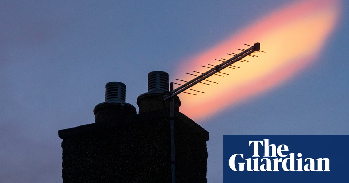
Photographs of unusual iridescent clouds in Scotland, northern England, and the West Midlands have been documented by meteorologists, prompting comparisons to unidentified flying objects (UFOs).
Nacreous clouds, which resemble mother of pearl, usually develop in extremely cold air above the polar regions, but were spotted on Tuesday over Edinburgh, Fife, Staffordshire, Merseyside, Lincolnshire and Cheshire.
The polar stratospheric clouds are most recognized for their enchanting pastel hues that are visible during twilight, occurring only at temperatures below -78C.
The phenomenon, similar to a thin coating of oil on the surface of water, occurs when sunlight bends or scatters around the small ice crystals within them.
On X, both forecasters and individuals in Scotland and England shared pictures and videos showcasing the uncommon clouds.
Tomasz Schafernaker, a meteorologist for BBC, tweeted in reply to recent photos of #NacreousClouds, stating that they can reach heights that are three times higher than a cruising airplane. These unique clouds are a sign of frigid air in the upper atmosphere.
Due to the frigid temperatures necessary for their creation, these clouds are typically observed in Scandinavia, northern Canada, and northern Russia.
The Met Office reports that these phenomena are typically observed above the UK when the polar vortex, a circulation of cold air in the stratosphere around the poles, is shifted and briefly lingers over the region. The last sighting was in January, over Scotland.
Stephen Dixon, a spokesperson for the Met Office, stated that nacreous clouds are not commonly seen in the UK and are found at high altitudes. These clouds can provide a captivating sight for viewers as they reflect the colorful light of the sun, typically occurring after sunset or before sunrise.
“These polar clouds are created from ice particles that are smaller compared to typical clouds. The size of these particles causes light to scatter differently, resulting in their distinct appearance.”
The forecast for the UK in the run-up to Christmas is less wondrous. The Met Office has issued a warning for high winds across the northern half of the UK on Thursday, bringing the potential for travel chaos.
A low pressure system located north of the UK will result in wind speeds ranging from 70-80mph in northern Scotland, 65-70mph in higher areas, and 45-55mph in Northern Ireland, Scotland, northern Wales, and northern England (above Birmingham) as well as the upper portion of East Anglia.
The Met Office has announced a wind warning, designated as yellow, that will be in effect from midnight to 9pm on Thursday. This indicates that travel may be affected and power outages are a possibility.
The Danish authorities have designated the low pressure system as Storm Pia, but it was not deemed significant enough in the UK to receive an official name.
According to Dixon, gusts are expected to reach 45-55mph in many areas, with the potential for 65-70mph in eastern Scotland’s elevated regions.
The most powerful gusts are expected in the northern and northeastern regions of Scotland, including the Northern Isles, reaching speeds of 70-80mph during the morning.
The Met Office predicts that there will be showers accompanied by strong winds, and that there will be additional rainfall on Friday.
According to Dixon, there is a chance of snowfall on Christmas Day, but it is limited to the northern regions of Scotland.
Source: theguardian.com


